Read
from various sources
pointclouds (las, laz, xyz, csv, ply…), geometries (wkb, ifc…)
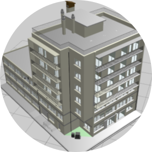
Py3dtiles is a python library and command-line tool designed for generating and managing 3D Tiles datasets, the OGC standard for streaming massive 3D geospatial content.
Read
from various sources
pointclouds (las, laz, xyz, csv, ply…), geometries (wkb, ifc…)
Write
your tileset and tiles
tileset.json, b3dm, pnts...
Manipulate
everything!
includes classes and methods to easily edit your tilesets and your tiles.
CLI
Get started quickly with our command-line tool
Py3dtiles icludes a command line tool to quickly get information about 3dtiles files or convert datasets.
py3dtiles convert --out="3dtiles" pointcloud.lasAPI
Integrate py3dtiles directly in your python app
Py3dtiles includes a rich API to read, write and manipulates 3dtiles datasets
import json
from pathlib import Path

from py3dtiles.tileset import TileSet


tileset_path = Path("tests/fixtures/tiles/tileset.json")
with tileset_path.open() as f:
    tileset = TileSet.from_dict(json.load(f))

Py3dtiles aims at being a swiss knife for converting and editing
tilesets. It can read and create tilesets and tilesets content. For
file conversion, it currently supports various pointclouds format
(las, xyz, ply...), wkb and ifc files.
It can be extended to add your own pointcloud reader or geometry
tiler. Lib usage allows it to be integrated into a larger
application or into data pipelines.